Tuesday, June 15, 2010

The English Explorers


Although Captain James Cook is the most famous of the English sailors to have landed in Australia, he was not the first. Cook’s 1770 voyage was preceded by that of the British ship the Triall, or Tryell, which in 1622 was wrecked on rocks that were probably to the north of the Monte Bello Islands, Western Australia. A number of survivors made it to Batavia (Jakarta) and described their harrowing experience, although their directions failed to turn up the rocks that caused the wreck, or the ship itself. In 1681 the London also approached New Holland’s west coast, but there is no evidence it landed near where the captain was able to draw the Abrolhos Islands, the location where the Batavia mutineers had held their rebellion in 1629.

Almost 100 years prior to Cook, in 1688, the Englishman William Dampier, often described as a reluctant pirate or buccaneer but also acknowledged as a knowledgeable naturalist (Wood 1969, Kenny 1995), was sailing with a group of pirates who had snatched the Cygnet and left its captain behind on a stopover in the Pacific. After visiting Southeast Asia, the pirates needed to avoid both Dutch and English ships and thus sailed to the east of the Philippines, south into Indonesia, and finally to Timor, where they turned south and landed in Australia (Wood 1969, 220).

In 1699 after the publication of a best seller based on his first journey, Dampier set sail again for the South Pacific, this time with the backing and legitimacy of the English Admiralty and Royal Society. Scientific exploration was the raison d’être of his mission, but what exactly he was expected to achieve was left vague: “He was told to discover ‘such things’ as might tend to the good of the nation and not to annoy the King’s subjects or allies” (Kenny 1995, 23).

His new ship, the Roebuck, sailed for New Holland at the start of 1699 and landed at Shark Bay, near Dirk Hartog Island, in July. He sailed north for about 994 miles (1,600 km) over the next five weeks, exploring all along the way. The results of this journey did not add significantly to what was known about the world at the time, as remained the case until 1770 when Cook finally made his way to the east coast of Australia, but did provide important descriptions of the continent’s unfamiliar plant and animal life, as well as judgmental descriptions of Aboriginal life (see Wood 1969, 221). Upon his return to Britain, Dampier penned his second best seller, A Voyage to New Holland, in which he described not only his Australian adventures but also time spent in New Guinea, Timor, and Brazil.

For 71 years between William Dampier’s second journey to New Holland and James Cook’s historic landing on the east coast, European activity in New Holland was extremely limited. Even the Dutch sent only two expeditions, in 1705 and 1756, which resulted in almost no new information about the imposing southern continent. After their final expedition, under Lt. Jean Etienne Gonzal, the VOC gave up on their large find in the South Pacific and left it to the Aboriginal people and occasional shipwreck victims.

This changed in 1768, when the British, following their victory over France and Spain in the Seven Years’ War in 1763, began thinking about expanding their colonial holdings and their scientific knowledge in the Pacific. James Cook’s first journey to New Holland in 1770 was motivated by these twin ambitions. His publicly stated task, given by the Royal Society, was to be in Tahiti on June 3, 1769, to observe the transit of Venus across the Sun, which previous British teams had failed to do during the transit of 1761.

The Royal Society, anxious to ensure its second attempt did not fail, approached the king and government with a request for £4,000 and a ship to send a scientific expedition to the South Seas for the express purpose of observing the transit. When the king agreed to the sum, the navy provided Lieutenant James Cook, who had had significant experience in North America, to command the ship HMB Endeavour and co-observe the transit with Charles Green, a Royal Society astronomer. The expedition was to observe the transit, chart new territory, gather as many specimens from the natural world as possible, and provide drawings, journals, and maps upon their return. As such the Endeavour carried a number of the best English scientific minds of the time, including Joseph Banks, an Oxford-trained botanist and later Cook’s good friend. Cook was also secretly directed by his superior officers to search the South Seas for sites that might yield financial gain, specifically in New Zealand, which had been “discovered” by Abel Tasman in 1642.

The expedition, by most accounts, was a success. As a result of the scientific explorations of Banks, Daniel Solander, and the others, about 1,400 new plant species and 1,000 animals were taken back to London. The one fairly significant failure on the scientific front, however, was the observation of the transit of Venus: Cook and Green’s observations differed by 42 seconds (Phillips 2008).

Despite the failure of the expedition’s stated mission, when Cook, Banks, and the others returned in 1771, they received a warm welcome in London due to their other accomplishments, scientific and other-wise. In political terms, certainly the most important was the claiming for England of New Zealand in 1769 and New South Wales in 1770. In New Zealand this event happened at Mercury Bay and in Australia at Possession Island, off the Cape York Peninsula, which Cook also named. Cook had actually landed on the eastern Australian coast four times, starting with Botany Bay, before he took possession of the land for King George III in August. In addition to New South Wales, Cook provided the newly “discovered” continent with many other placenames. The first was Point Hicks on the northern Victorian coast, named for the Endeavour’s first lieutenant, Zachary Hicks, the first to see this outcropping of land.


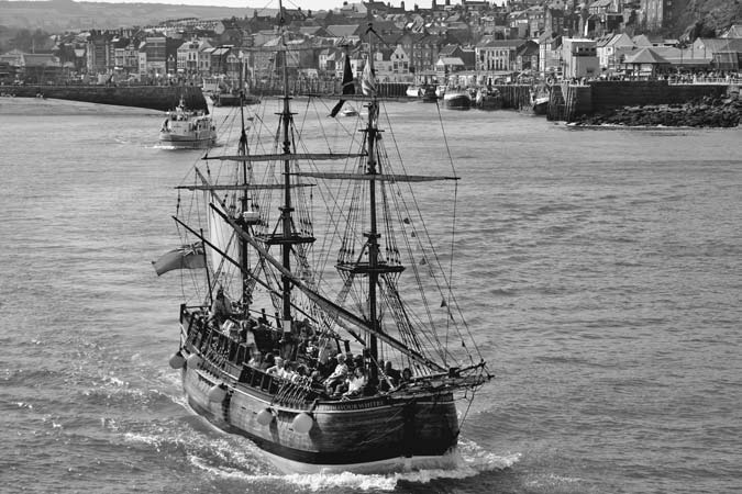
A replica of Captain James Cook’s ship HMB Endeavour, during his first voyage to Australia. Cook’s home harbor of Whitby, Yorkshire, England. (George Green/Shutterstock)

In addition to the vast number of scientific specimens and amount of knowledge they gathered, Cook and his crew provided the backdrop for Britain’s later colonization of its new possession. It was actually the ship’s head botanist, Banks, who in 1779 suggested to the Pitt government in London that Botany Bay might be a suitable place to deposit criminals who had been sentenced to transportation. The American colonies had been used for that purpose for many decades; about 50,000 people were sent there between 1650 and 1775 (Morgan and Rushton 2004). For a few years after the American Revolution stopped this practice, convicted felons in England served their sentences in the hulls of prison ships, until transportation began anew in 1788, commencing a whole new chapter in Australian history.

Before this initial settlement, however, in 1772 Cook and Captain Tobias Furneaux sailed again for the southern ocean to continue English exploration of the new continent. Although Cook never returned to Australian waters, Furneaux, in the HMS Adventure, used the opportunity to survey Van Diemen’s Land. While he explored much of the region, he was badly mistaken in his report to Cook that Van Diemen’s Land was connected to the New South Wales mainland. Cook had no reason to doubt his second in command and thus never returned to the region to investigate it for himself.

The last important English explorer of Australia’s unknown coastlines was Matthew Flinders. Together with his childhood friend Dr. George Bass and William Martin, Flinders began in 1795 by exploring the intricate coastline around Port Jackson in their tiny, six-foot boat, the Tom Thumb. Their expertise led the second governor of the new colony, John Hunter, to provide them with a real ship in which to clarify the status of Van Diemen’s Land as an island or peninsula. The three explorers returned to Port Jackson in 1798 having circumnavigated the island and thus were able to confirm its separation from the mainland. After journeying to England to gain support for his plan to circumnavigate Terra Australis, in 1801–02 Flinders was the first to chart the entire southern coast of the continent, from Cape Leeuwin in the far southwest, across the Bight, into Port Phillip Bay in Victoria, and north to Port Jackson. In July 1802 Flinders began his 11-month journey around the continent, which he called Australia, thus proving to all that New Holland and New South Wales were the same landmass. Unfortunately, after completing this journey, Flinders never returned to Australia again. On his way back to England he was held prisoner in Mauritius from December 1803 through June 1810 because of the Napoleonic Wars between Britain and France and died at the age of 40 after completing his massive work, A Voyage to Terra Australis, published just one day before his death in July 1814 (Cooper 1966).

Monday, June 14, 2010

The Dutch Explorers - Australia

In 1606 the Dutch sailor Willem Janszoon (sometimes abbreviated to Jansz) became the first European to document the existence of Australia. Between that first sighting and 1756, 19 Dutch ships were sent to Australia during the course of eight separate expeditions and a further 23 ships approached the continent while maneuvering to or from the Dutch colonies in the Indonesian archipelago (Sheehan 2008).

These expeditions were part of the larger mercantile and military exploits of the Verenigde Oost-Indische Compagnie, or United (Dutch) East India Company (VOC). The background for this exploration was geopolitical in nature. The 80 years’ war between Protestant Holland and Roman Catholic Spain and Portugal meant that the Dutch lost access to the exotic spices sold in the markets at Lisbon. Their answer to this problem was to seek their own path to the spice islands, resulting in their 1595 mission around the Cape of Good Hope and the eventual establishment of the very successful Dutch colony in what is today Indonesia.

One of the ships on that first mission in 1595 was the Duyfken, or “Little Dove,” which was to make history just seven years later as the first fully documented European ship to call in on the Australian continent, probably at the Pennefather River on the west coast of the Cape York Peninsula. The Duyfken on this fateful trip was captained by Willem Janszoon. His mission, when he set sail under a VOC flag from Bantam in West Java, was to find out whether great wealth in gold was actually to be found in New Guinea, as persistent rumors maintained (Kenny 1995). Besides gold he would also have been seeking other salable commodities, from spices to fur.

Although neither Janszoon nor other VOC sailors found much to recommend the Australian continent, which they called New Holland, they soon charted a significant amount of the coastline: 11,713 miles (18,850 km), or 52.5 percent of the continent, from as far south as Nuyts Archipelago on the Great Australian Bight, along the western and northern coasts to western Cape York. In 1642 they also claimed Tasmania, which they called Van Diemen’s Land in honor of the VOC governor-general who had commissioned Abel Tasman’s expedition. The landing party placed the flag of the prince of Orange on the shore but saw no indigenous Tasmanians. Tasman was vague about the borders of his country’s new colony, but for nearly two centuries the prior Dutch exploration of west Australia, still called New Holland, was respected by the other European powers, which turned their attention to the relatively unexplored east coast.

Although Tasman failed to make contact with the Aboriginal people, certainly other Dutch explorers did have interactions with them, of both a positive and a negative nature. Reports vary, but it can be stated with relative certainty that at least one Dutchman was killed when Janszoon’s crew went ashore at the Wenlock River on the Cape York Peninsula. Jan Carstenszoon, who landed on Australia’s west coast in 1623, even offered financial incentives to his crew for the capture of Aboriginal people, and a number of them were taken back to Dutch headquarters in Batavia (Jakarta) and Ambon, where their trail disappears. In 1629 the Dutch ship Batavia was wrecked off the west coast and two of the survivors were banished to the mainland for mutiny. The two were provided with food, guns, and a number of trade goods such as mirrors and beads and told to “learn what they could about the country” as the first recorded European inhabitants of Australia/New Holland (Kenny 1995, 26). They were never seen by Europeans again but must have interacted in some way with the local population.

European Exploration and Early Settlement (1606–1850)

The European “discovery” of Australia and the entire South Pacific region was part of the much larger process of European exploration and colonization throughout the world that began with Bartolomeu Diaz’s Portuguese expedition to the Cape of Good Hope at the southern tip of Africa in the 1480s and continues today in French New Caledonia and elsewhere. The earliest explorers were the Portuguese and Spanish, who were driven by the twin motivations of “God and gold” to seek new routes to the East and to expand the boundaries of the known world.

Despite the importance of Spain and Portugal in the Age of Exploration, there is only circumstantial evidence that explorers from those countries sailed as far south as Australia during this period. The one exception to this is Portuguese sailor Luis Váez de Torres, who sailed from Peru under the Spanish flag with Pedro Fernández de Quiros, European discoverer of the Solomon Islands. On their 1606 expedition Torres’s ship became separated from the others and wound up sailing through the strait between Australia and New Guinea only a short time after Janszoon’s historic landing on Cape York (Kenny 1995). There is little doubt that Torres saw the mainland, but he seems to have mistaken it for yet another island and failed to go ashore or report to the Spanish the existence of the legendary southern continent. Nonetheless, his charts did later end up in the library of Captain James Cook, who persisted in his long and difficult journey through the Great Barrier Reef in the hope that the information was accurate and that he could sail to the west between Australia and New Guinea. Today the strait explored by Torres bears his name in honor of his early achievement.


Language - Aboriginal culture

A third feature of Aboriginal culture that is evident today and indicative of great changes over the tens of thousands of years of Aboriginal residence in Australia is the clustering of all Aboriginal languages into two large groups, Pama-Nyungan and non-Pama-Nyungan, which is sometimes also called Arafuran (Clendon 2006). The former family includes the languages spoken in nine-tenths of the country’s geographic territory, from the rain forests of Queensland to the temperate regions of Western Australia and Victoria, including most of the arid center of the country. The latter category, however, contains 90 percent of the continent’s precolonial language diversity in just 10 percent of its territory (see map on page 14). Many theories have been put forward to explain both the prevalence of Pama-Nyungan throughout the continent, despite its relatively young age, estimated at about 5,000 years (O’Grady and Hale 2004, 91), and the great diversity of the non- Pama-Nyungan languages. Some of these theories include the separation of these two groups in antiquity and subsequent differentiation over time; others posit that an incoming migratory group introduced dingoes, new stone tool technology, and Pama-Nyungan languages several thousand years ago (Mulvaney and Kamminga 1999, 73–74). It is more likely, according to O’Grady and Hale, that a single population spread their language across nine tenths of the continent as a result of an unknown internal factor. Some hypotheses concerning this spread include innovations in intellectual property such as songlines, kinship structures, and art styles; developments in material culture; or natural causes (O’Grady and Hale 2004, 92).

As is evident from these few select cultural features and historical trends, even prior to the colonial period in Australia the continent housed a dynamic, diverse population that over many millennia had continually adapted to climate and social change. The Aboriginal Australians living in the far north of the country had also adapted to a trading regime, with fishermen and traders visiting their territory from the islands of contemporary Indonesia. Although the exact date of their first landing in Australia is unknown, the early 15th century is posited as the most probable time when fishermen from the north first arrived in large numbers. Macassan hunters of trepang began to interact with Aboriginal Australians two centuries later. The Chinese may also have landed in the far north, although it is possible that the Ming dynasty statue found near Darwin was carried by Macassans rather than Chinese sailors themselves.


Religion - Australian Aboriginal religion

Dreaming stories form the basis of Australian Aboriginal religion. They provide explanations for how and why the world is the way it is, which usually relate to the actions of ancestors who created the world. The world depicted in these stories is much more complex than that of most Westerners, for whom the natural and supernatural, past and present, sacred and profane are separate. For Aboriginal Australians, these planes of existence are intertwined. Ancient ancestors created the world and everything in it, including rocks, lakes, animals, humans, the wind, and rain, but are also active in the present. Their past actions cannot be separated from present actions, especially in ritual, which remakes the world each time it is undertaken. The song lines or footprints of these ancient ancestors continue to cross the Australian continent and carry information back and forth from one community to another. Sacred spaces along these lines coexist with everyday or profane spaces, often materialized in rocks, rivers, and other geological features. Because of this continual sacred presence and the association in English with sleeping, many Aboriginal people prefer not to use the term Dreaming to refer to their religious beliefs but instead rely on the term used in their own language. Anthropologists sometimes use “the everywhen” to refer to the context of Dreaming stories in order to indicate their timelessness (Bourke, Bourke, and Edwards 1998, 79).

As is the case with specific kinship structures, Aboriginal religion is another area of indigenous culture in which 19th-century concepts and ideas may not represent beliefs and practices that are as ancient as the Aboriginal population in Australia as a whole. As mentioned, there is little evidence for the rock art that depicts Dreaming stories in Australia prior to the post-LGM period. The archaeologist Bruno David takes this argument even further, claiming that modern Dreaming did not emerge until between 3500 and 1400 BP (2002, 209). He reminds us that “modern Dreaming stories cannot be used as evidence for the Dreaming’s great antiquity, despite the possibility that a story’s contents may represent traces of particular historical events passed down in folk memory” (2002, 91). That said, there is solid archaeological evidence that Dreaming has been the basis of Aboriginal Australian religion for several thousand years, affecting both belief and practice through the present.

Another feature of Aboriginal religion is the sacred or totemic nature of certain plants, animals, geographic features, and other aspects of nature, including the Moon. Each clan not only is represented by its totem but is said to embody and be descended from it. For example, members of the kangaroo clan are believed to have had the same ancestor as contemporary kangaroos; the same is true of the spinifex clan, witchety grub clan, and so on. As a result, these animals and plants are sacred to their particular groups, who must not hunt or eat them or use them for other profane purposes.

As do other religions, Aboriginal religion has a body of myth contained in its creation stories, rules and prohibitions to follow, and a series of rituals that bring the myths to life. Religious rituals, regardless of the tradition in which they originate, are about regularly enacting the sacred moments of the believers’ history. For example, Christians partake in communion to reenact the last supper, when the apostles gave life to Jesus despite the sacrifice of his body on Earth. Aboriginal rituals likewise reenact the most important moments in the lives of their sacred ancestors as a way of connecting past and present. Rituals also provide moments for younger Aboriginal people to learn from their elders the words to songs, the moves to dances, the beat to songs, and the power of the ancestors in the past and present world.

Culture

As is the case with so many features of precontact life there is contemporary debate about whether the conceptual and structural aspects of Aboriginal cultural life evident to Europeans in the 19th century were continuations from the past or relatively new adaptations to the colonial world. For example, Peter Hiscock believes that the complex Aboriginal kinship systems evident to Europeans at the end of the 19th century were the result of dramatic population loss from smallpox in 1789 rather than a continuation of precontact structures, while others, such as Ian Keen and Josephine Flood, disagree (Molloy 2008).

Kinship

While many aspects of Aboriginal life changed dramatically with the arrival of Europeans and the devastation of communities through disease and genocide, the evidence both from Australia and from band societies more generally is that although specific details of each kin structure may have changed, the centrality of kinship did not. The foundation of Aboriginal culture and society in the period before European contact had to have been kinship. All laws, residential patterns, taboos, and other aspects of communal life were dictated by kinship principles. Individual relationships, from food sharing requirements and other etiquette rules to potential marriage partners, were also dictated largely by kinship, in association with residency, which itself was largely directed by kinship. In the contemporary world this code remains very important, even for the majority of Aboriginal Australians who live in urban areas.

Rather than blood ties, the most important aspect of Aboriginal kinship systems is classification. In U.S.-American kinship there is a degree of classification, such as all children of your parents’ siblings are classified as cousins. This pattern is quite different from other kinship systems, in which the children of your mother’s siblings are called something different from the children of your father’s siblings; some systems are even more complex in that mother’s and father’s older siblings’ children are called something different from their younger siblings’ children. Aboriginal classification included not only cousins but everyone in the band or even tribe. For example, a father, his brothers, and his male lineal cousins are all called father; a mother, her sisters, and her female lineal cousins are all called mother. This does not mean that Aboriginal people did not know who their actual mother and father were, but that rights and responsibilities extended far beyond the nuclear family.

Classificatory kinship systems create very large webs of ties between individuals that cut across not only time but space. If two strangers of the same tribe meet, they immediately figure out how they are connected, as cousins, mother and child, father and child, grandparent and child, or whatever, so they are able to use the appropriate kinship term to refer to each other and to obey all the other taboos associated with kinship. One of the most interesting aspects of these kinship rules for many outsiders is the pattern of avoidance relationships many Aboriginal people are required to follow. The most common of these is the in-law avoidance relationship, in which men and women are not permitted to be alone in the room with their spouse’s parents, are not permitted to speak to them directly, and must never engage in joking or other lighthearted activity with them. While not all Aboriginal groups had these kinds of avoidance relationships between categories of relatives, many did and still do to this day.

Although Aboriginal Australians had one of the simplest tool kits of all the colonized peoples in the world, they may also have had some of the most complex structures to manage their webs of kinship. In many tribes each individual was a member of a family, lineage, clan, tribe, subsection, section, and moiety. Individuals had to manage different kinds of relationships with each person based on these categories, including joking and avoidance requirements, exogamy and endogamy rules, and obligations of social and economic reciprocity.

Prehistory: 22,000 BP–1605 c.e.


Sahul’s climate changed dramatically during the period of the last glacial maximal, between 22,000 BP and 17,000 BP. Average temperatures were quite a bit lower than previously, and dry winds made those temperatures feel even colder. Evaporation rates were higher than either today or in the previous period, and rainfall is estimated to have been about half of what it is today (Hiscock 2008, 58). This period was exceptionally difficult for humans in Sahul due to loss of food sources through extinctions, lack of water, and the cold. As a result of these changes, many pre-LGM settlements show no activity at all during this period; some of these sites are at Lake Eyre and the Strzelecki and Great Sandy deserts (Hiscock 2008, 60). These sites were probably so dry that even underground and other previously reliable water sources dried up and thus could not support life; another theory is that the areas around these sites became so dry that it was impossible for large groups to carry enough water with them to migrate into them.

Another feature of Sahul during the LGM was the final extinction of a large group of animals referred to as megafauna, including 10-foot-tall kangaroos and diprotodontids, which looked most like contemporary rhinoceroses but were marsupials rather than placental mammals. The cause of this extinction remains a contentious issue today with some scientists, such as Tim Flannery (1994, 2004), claiming a direct link between this mass extinction and the Aboriginal population’s hunting or land-use schemes, and others favoring a direct link between climate change and extinction. Stan Florek (2003) of the Australian Museum in Sydney is a proponent of the latter theory, who argues that temperature changes without any significant rise in moisture levels contributed to the drying out of the continent’s inland lakes and thus the death of the animals that relied on their water. Peter Hiscock (2008, 72–75) likewise draws on evidence from a variety of archaeologists, especially Judith Field’s work at Cuddie Springs, to argue for climate change as the source of not only LGM extinctions but also those of many other large marsupials between 200,000 BP and the LGM. Along with Hiscock, the present author cannot rule out that humans may have assisted in the extinction of some animals through either hunting or disrupting their natural habitats, but it seems clear that the earliest Aboriginal populations did not kill off Sahul’s megafauna.

After the end of the last glacial maximal about 17,000 years ago, conditions in Sahul began to change. These changes were not rapid by contemporary standards but over the course of thousands of years did force the human population on Sahul to make many significant adaptations. The most important cause of these changes was the rise in global sea levels, which over the course of 10,000 years eventually separated the Australian mainland from Tasmania and New Guinea. In addition to the loss of territory, climate change affected the continent in ways that are still not understood. Warmer conditions and an increase in carbon dioxide (CO2) in the atmosphere may have set the stage for more plant life. Greater rainfall may have opened up certain desert locations that had been abandoned during the LGM, while warmer temperatures may have caused this additional moisture to evaporate as soon as it fell.

While domestication of animals and plants was largely impossible in the Australian context because of a lack of suitable native species (Diamond 1999), post-LGM archaeological sites indicate other, significant changes in both social and material life for humans on the continent. Socially, the decrease in available territory caused by inundation contributed to higher population densities. This fundamental change, however, does not seem to have brought about any categorical change in social structure. Post-LGM Aboriginal societies remained bands, organized around the dual principles of kinship and residence and exhibiting all of the relative equality of their pre-LGM ancestors. Even in New Guinea, where population pressures about 9,000 years ago contributed to the domestication of plants and the development of a horticultural subsistence base, extensive redistribution systems eliminated differences in wealth almost as soon as they emerged and no formal leadership roles developed prior to the colonial era. The same was certainly true in Australia, where horticulture could not develop, making it impossible to accumulate large food surpluses.

The combination of higher population densities and climate change also caused many material changes to post-LGM Aboriginal life, especially the need for more intensive utilization of resources in each locality. For example, many of the chert tools and fragments found in pre-LGM and LGM era middens had been carried far from their original sources. For many archaeologists, this indicates greater mobility at that time due to the requirements of hunting and gathering in the cold, dry climate. This mobility also points to the ability of each band to roam far and wide without encroaching on the territory of other bands. In some post-LGM sites, most chert remains are found quite close to their source and thus indicate longer residence in each place and reduced mobility due to an increase in overall population (O’Connell and Allen 2004). However, these conclusions have been challenged by findings that some large stone tools, such as axes, were discovered farther from their original sites during the pre- and post-LGM periods than during that period, when dryness and cold may have prevented some migratory routes and camping sites from being used. Many post-LGM sites also indicate that trade relations increased in that period and thus gave each band access to a somewhat wider array of goods without their being forced to migrate.

Another important material change in the post-LGM context was the widespread creation of art and body decorations. Very few pre- LGM sites indicate the presence of red or yellow ochre or any other artistic media. All of the rock art for which Aboriginal Australians are famous, such as X-ray art of animals and dot paintings showing song lines and the footsteps of the ancestors, was created in the post-LGM period. Whether this material change is indicative of greater complexity in Aboriginal religious and ritual life at this time or another result of higher population densities and reduced mobility may never be known. A further possibility is that all pre-LGM rock art was destroyed by inundation or simply eroded over time. The fact that there are two possible examples of pre-LGM rock art in the Cape York Peninsula area of northern Australia in the form of ochre smudges on rock overhangs may provide evidence for this theory.


X-ray painting and dot painting are the two best-known forms of traditional Aboriginal art. This example comes from the Kakadu region of the Northern Territory. (Neale/Shutterstock)

After the LGM, Aboriginal people also began to make more widespread changes to their natural environment than they had prior to and during the LGM. The use of fire is one land management strategy that may have been practiced prior to the LGM but nonetheless became very widespread after it, as seen at a large number of post-LGM archaeological sites. As do contemporary Aboriginal people, these ancient ancestors may have used fire to locate and isolate animals for easier hunting as well as to promote the growth of vegetation, which would also have attracted animals. In addition to the use of fire to control plant growth, there is evidence that both plants and small animals were carried from place to place to encourage their growth in new habitats. Lack of suitable candidates for domestication, such as those that could have provided enough food effectively to replace hunting and gathering, however, meant that domestication of these plants never occurred. Indeed, even in the postcolonial context, the only native Australian plant to have been domesticated for widespread human consumption is the macadamia nut, and no native animal has been domesticated (Diamond 1999).

As have other aspects of the most ancient Aboriginal history, this hypothesis concerning greater control of the natural environment in the post-LGM period has been challenged. For example, some prehistorians have used evidence of heavily used stone axes in a few pre-LGM sites, combined with pollen studies indicating greater forest cover in central Australia prior to 60,000 BP, to argue that the first migrants to the country cut down large swaths of forest in that region. The argument is that the resulting lack of trees contributed to desertification, indicating very intensive interactions between pre-LGM populations and their environment (Groube 1989, Miller, Mangan, Pollard, Thompson, Felzer, and Magee 2005). This remains a contentious hypothesis that requires far more evidence than is currently available.

In addition to exerting their control over the land through the use of fire and over certain animals and plants, the post-LGM Aboriginal population in some locales dug channels and weirs for trapping fish and eels. These land management practices indicate not only a deep knowledge of the local environment but also, contrary to what the early British settlers thought, a strong commitment to particular parcels of land. While Aboriginal people did not have large food surpluses because of a lack of domesticable plants and animals that would have allowed them to build permanent towns and cities, they did not simply live in a state of nature. Each community owned the rights to use parcels of land and their resources and managed those parcels with complex strategies of burning, planting, animal transfers, and animal management.

Ancient Prehistory: 60,000–22,000 BP

Since the arrival of the first Aboriginal people about 60,000 years ago, the Australian continent has undergone tremendous change. When they arrived, present-day Australia, Tasmania, the Torres Strait Islands, and the island of New Guinea were all connected. These lands formed the continent of Sahul, a landmass approximately the size of contemporary Europe west of the Ural Mountains. The continent contained a large number of unique plant and animal species due to its long period of isolation (about 38 million years) from other landmasses, including an estimated 13 species of so-called megafauna. These were very large versions of contemporary kangaroos, wombats, and other marsupials; many other species of megafauna had died out prior to the continent’s inhabitation by humans. The climate was generally cooler and drier than the region is today, with periglacial and even glacial regions in the Highlands of New Guinea and the Dividing Ranges of southeastern Australia. Nonetheless, Sahul 60,000 years ago encompassed the same wide variety of ecological niches as today’s separate landmasses. Tropical forests covered the northern lowlands, while temperate forests existed in the south and highlands of the north. The center of the continent contained both deserts and savannahs, as it does today. Some pollen studies appear to show that even the continent’s dry center contained some forest land, but this hypothesis has not been accepted by all archaeologists or other scientists working in this area.

Even though there is no absolute certainty about the direction from which the ancient migrating population arrived on Sahul, the most viable hypothesis is that after spending thousands of years leaving Africa, passing through the Middle East and India, and heading south through mainland Southeast Asia, which was then much larger than today, a small group of migrants sailed across about 35 miles of open sea to land somewhere in Sahul’s far north, or contemporary New Guinea. Other hypotheses, such as migration direct from India or even the in situ evolution of humanity in Sahul, have been disproven in recent decades with the development of mitochondrial deoxyribonucleic acid (mtDNA) analysis.

Like the migration route, the period of initial migration is also a highly contested feature of Aboriginal Australian history that involves archaeologists, physical anthropologists, geneticists, linguists, botanists, and a host of other scientists. Most Aboriginal people themselves find this debate irrelevant or even insulting, for it discounts their own origin myths, which are timeless. Nonetheless, until the 1960s, most scientists believed the original period of migration was as recent as about 10,000–12,000 years ago, or about the same time as the colonization of the Americas from northern Asia. With the development of advanced carbon 14 dating techniques, this date was pushed out toward 40,000 years before the present (BP) by the middle of the 1980s. And with the development of thermoluminescence dating in the 1990s, 60,000 years BP has become a common estimate. Genetic testing of mitochondrial DNA, which looks at female lineages of certain genes and determines age through the evaluation of gene mutations, has also provided dates of around 60,000 years BP for the initial peopling of the continent.

Nonetheless, contradictory evidence from other disciplines has compelled scientists to continue exploring this intriguing subject. For example, pollen studies that show an increase in the existence of fire on the continent, which may indicate human use of fire to clear territory and make hunting easier, have indicated that it is remotely possible that humans were using fire in Australia as far back as 185,000 years ago. The use of TL on materials found in Jinmium, Western Australia, has likewise produced a date as far back as 176,000 years, though this has since been forcefully rebutted by others. On the other side of the debate, archaeologists have found very few sites in Sahul that can be verified as having existed more than 40,000 years ago. In their review of all the evidence that had been retested using thermoluminescence and other techniques, O’Connell and Allen (2004) conclude that even with these new technologies, 45,000 BP is the earliest date for which we can be certain of human inhabitation of Sahul. Nevertheless, because their conclusions do not take genetic evidence into account, many consider this a conservative date.

Another problem with our understanding of the initial peopling of Sahul is whether one migrant population settled and spread slowly to all corners of the continent, from the Highlands of New Guinea to the southern tip of Tasmania, or whether there was a continual flow of migrants over many thousands of years. Discrepancies in the archaeological record, such as the fact that the oldest archaeological sites have been found in Australia’s southeastern states of New South Wales and Tasmania rather than northern regions, and the odd division of Australian languages into two groupings, Pama-Nyungan and non-Pama-Nyungan, have convinced many scholars over the years that Australia was populated by several waves of people from India as well as Southeast Asia. In addition, simulation studies, which use computer modeling in the creation of hypotheses, have posited that there have to have been multiple migratory groups to Sahul to prevent incest and sex imbalances.

What these simulation studies do not tell us, however, is whether or not these multiple migrations took place over several years, decades, centuries, or even millennia. As a result of recent studies, physical anthropologists and geneticists working in the area of mtDNA believe they have answered this long-standing question in favor of the shortest possible time lag between migrations. Their data show with relative certainty that Australia, New Guinea, and all of Melanesia were populated by a single group of migrants who left Africa 70,000 years ago at the earliest and populated their current home about 58,000 years ago, plus or minus 8,000 years (Hudjashova et al. 2007). This same evidence also points to a long period of relative isolation after this initial migration, whereby even prior to the submergence of the land bridge linking Australia and New Guinea, the populations of these two regions remained largely separate. The only exception to this trend evidenced by the genetic material tested so far is an influx of New Guineans into northern Australia about 30,000 years ago.

The history of this population remains fairly vague after they began settling Sahul. We do not know whether communities fought wars against each other or were so spread out on the vast continent as to be able to live peaceably. We do not know how soon their proto-Australian language or languages began dividing into the vast number of Australian and Papuan languages evident by the time of European contact in the 17th century. We do not know whether the Dreaming stories and their accompanying rituals, which make up the backbone of Aboriginal religion even today, were imported with them, were developed during the period of migration, or were begun after settlement on the continent. The list of unanswered and probably unanswerable questions about this most ancient of populations is very long.

Nevertheless, on the basis of the somewhat sparse archaeological record of about 100 sites identified to be older than 22,000 years, the period of the last glacial maximal (LGM) and a period of dramatic change on the continent, we do have a very good idea about a few aspects of life on prehistoric Sahul. Archaeologists working at sites as far removed as Lake Mungo’s Willandra area in western New South Wales, Parmepar Meethaner in Tasmania, and Yombon on New Britain, New Guinea, have found remains dating from before 22,000 BP. While some aspects of these ancient populations’ tool kits and subsistence regimes were similar, others differed. For example, people in all three regions lived on a food collectors’ diet consisting largely of fish, shellfish, and small mammals. Of course local fruits, roots, greens, mushrooms, and other gathered foods would also have made up a substantial portion of their diet, as attested by the evidence provided by contemporary food collectors. But none of these foods left behind remains that could survive in middens, prehistoric garbage dumps the way that shells and bones could, and so their exact importance can only be surmised today. Other material finds include grinding stones for processing seeds and grains; tools made from flaked chert (a sedimentary rock), which often had been carried relatively long distances; and even a few tools prepared from animal bones, mostly those of kangaroos and large wallabies. In the north heavy stone axes have been found in the most ancient middens, while in the south this kind of tool emerged only in the past few thousand years (Hiscock 2008, 110).


Midden of mollusk shells and crustaceans near Weipa, on the northwest coast of the Cape
York Peninsula, Queensland (National Archives of Australia: A1200, L26732)

In addition to information about the content of the earliest Aboriginal people’s diet and tool kits, middens are important sources of information about ancient social structures. The small size of the pre-LGM middens found in Australia, Tasmania, and New Guinea indicates that the people who created them must have migrated often, from daily to seasonally, depending on locale and season. This kind of migration pattern is generally indicative of very low populations and population densities; relative equality between all adults, where the only distinctions are age and sex; no craft specialization or division of labor aside from those based on age and sex; no formal political or leadership roles; no concept of private property; a highly varied diet; and minimal risk of starvation.

Cultural anthropologists refer to societies organized in this manner as bands, social units made up of groups of related people who live together, move together, and, when necessitated by food shortages or conflict, split up and create two new bands or move in with other kinsfolk to expand preexisting bands. This inherent mobility, which facilitates access to foods as they ripen or become available and ability to harvest them in a sustainable manner, also limits people in band societies to minimal portable possessions, usually just carrying bags, weapons, and possibly some light tools or ritual objects. Everything else, from heavy stone tools to clothing, is made from local resources in each new residence. Housing would have been in either caves or leantos made anew in each location.

Some of the features associated with band societies, such as having a highly varied diet and minimal risk of starvation, may seem contradictory to the modern image of premodern life as “solitary, poor, nasty, brutish, and short,” as Thomas Hobbes put it in 1651. And we cannot be certain that life in pre-LGM Sahul was similar to the life of food collectors who lived in bands in the 20th century, where on average only about four hours per day were required to make, gather, and hunt all the necessities of life. Nonetheless, there is no evidence that this ancient Sahul population differed significantly from these more contemporary band societies. The Australian environment probably provided significant protein and vegetable matter in the form of seafoods, fish, mammals, grubs, roots, and fruit. The very low populations and population densities probably allowed each group to move as needed to seek out sources of food and water. Unlike most agricultural societies, which are at great risk of famine because most calories are consumed from just one grain, such as corn, rice, or wheat, or from a single starch such as sago, potatoes, or cassava, food collectors have access to a wide array of foods. There is very little risk inherent in food collecting because when there is a shortage of one food, a variety of others is usually available, and there is always the possibility for migration to new, more resourcerich areas.

In general, then, we can conclude that life in pre-LGM Sahul was of a very small scale. Small groups of related individuals moved with relative frequency to find food, shelter, and water. While all adults likely had a say in a move, the words of elders and men were probably taken more seriously than those of younger people or women. This is merely conjecture, but evidence of other food collecting band societies, including Aboriginal Australians at the time of European contact, suggests that men’s freedom from pregnancy and breast-feeding probably gave them greater mobility, knowledge of further distances, and thus a greater say in a band’s movements. Aside from these differences based on age and gender, these societies would have exhibited no class or caste distinctions and all members of the band would have had access to food and other things as needed.

Aboriginal History (60,000 BP –1605 c.e.)

Aboriginal history from 60,000 years ago until Australia was first sighted by Europeans in 1606 is as complex and varied as the history of any other group of people on Earth. Saying that today’s population of Aboriginal Australians are members of the oldest surviving culture in the world by many tens of thousands of years is not synonymous with saying that their culture has not changed during this very long period of time, or even that it had not changed prior to the arrival of Europeans in the early 17th century. Tremendous ecological changes, from the rise of global sea levels that separated Tasmania, New Guinea, and Australia’s mainland, to the loss of the continent’s megafauna, certainly contributed to great changes in people’s social and material lives. Other changes in social structures, social systems, languages, and technological know-how are also sure to have taken place over the course of this span of 60,000 years. Migration, warfare, floods, drought, animal and plant extinctions, overseas trade, and a vast array of other factors were also at play in the lives of the millions of individuals who lived and died on the continent before the arrival of the Dutch.

Despite this certain diversity and change, the historical record for these populations remains fairly sparse for a number of reasons. First, at no point in their precolonial history did Australia’s Aboriginal populations develop writing, and so they left no record of events. Second, ecological change has placed the earliest archaeological sites on the continent under water. Third, our science is not yet able to verify with 100 percent reliability the dates of organic materials from as far back as the earliest migrations. Finally, vastly different views of the nature of existence between Aboriginal and other peoples mean that Aboriginal oral histories have often been misunderstood when told to outsiders.


As a result of this confluence of factors, most Aboriginal history has to be patched together from a very incomplete archaeological record, linguistic evidence from our contemporary knowledge of Aboriginal languages, genetic comparisons between contemporary peoples who may have descended from common ancestors, oral histories and other stories gathered at the time of the first interactions between Aboriginal and non-Aboriginal peoples, and ethnographic information gathered over the past 400 years of interaction. Of course, a certain degree of conjecture based on these various sources of information is also inherent in this kind of salvage history writing but will be kept here to only the most viable hypotheses based on the hard evidence currently available.

People - The population of Australia

The population of Australia at 6:33 p.m. on January 22, 2010, was estimated by the Australian Bureau of Statistics to be 22,124,694 (Australian Bureau of Statistics 2009, “Population Clock”). This number is based on a formula that one birth occurs in Australia every one minute, 55 seconds; one death occurs every three minutes, 57 seconds; and the net gain from migration is one person every two minutes, 38 seconds. The total population increase is one person every one minute, 33 seconds (Australian Bureau of Statistics 2009, “Population Clock”). For a landmass approximately the size of the continental United States, a population of just over 22 million people would seem to be low, and the population density is one of the lowest in the world, at about 7.5 people per square mile (2.6 people per sq. km). But according to some of the world’s leading scientists, Australia is already overcrowded, and substantially so! Jared Diamond cites an estimate that Australian soil and water resources are enough to support a population of only about eight million (2005, 398).

Although throughout the 20th century the most significant cause of this population growth was natural increase, making up “67% of the population growth between 1901 and 1994” (Australian Bureau of Statistics 2006), immigration has in many years been a far more important factor. For example, in 2006–07 the net increase from migration was 155,600 people, representing 56 percent of the overall population increase in that year (Australian Bureau of Statistics 2007, “Migration”). This feature of Australian society is nothing new. In such boom years as those that followed the gold rush of 1851 and the postwar “populate or perish” years starting in 1945, migration provided many thousands more Australians than did natural increase. During World War I, World War II, and the depression in the 1930s, however, immigration nearly ceased.

The United Kingdom has been the most consistent source of Australian migrants over the past 200 years. Even during the peak of postwar migration, when displaced persons from Europe flocked to Australia by the tens of thousands, the United Kingdom provided the largest number of migrants. As late as 2006, 23 percent of the country’s overseas-born population hailed from there (Australian Bureau of Statistics 2007, “Migration”).

Because of this overwhelming majority in the early days, the popular image of Australia is of a largely homogeneous Anglo population prior to the start of European migration in the late 1940s; however, this image is not entirely accurate. The country’s Aboriginal people have always constituted a small percentage of the population. In addition, even in the days of the First Fleet in 1788, immigration to Australia was never entirely English or even British. The First Fleet carried people of English and Scottish nationality but also Germans, Norwegians, and both black and white Americans to Australia’s shores. Irish convicts arrived in 1791, and that country has continued to be an important source of immigrants, so much so that the dominant population in Australia is usually referred to as Anglo-Celtic rather than simply Anglo or English. Significant numbers of Chinese, Japanese, and Malays from Indonesia resided in the Northern Territory long before there was any large-scale European immigration to that region; in 1888 the Chinese population of the Northern Territory was seven times larger than the white one (Thompson 1994, 37). The gold rushes of the 1850s also drew people from all over the world to Australia’s shores, as did the scores of inland expeditions in the decades that followed. Although small in number, Australia was also home to a population of Muslims from Afghanistan, Pakistan, and India starting in the 1860s; the country’s first mosque was built in Renmark, South Australia, in 1861 and the second in that state’s capital, Adelaide, in 1889 (Islamic College).

Since the influx of European migrants after 1945 and the dismantling of the white Australia policy in the final quarter of the 20th century, Australia has become increasingly diverse. In 2006 the next largest migrant populations after the British and New Zealanders were Italians, Chinese, Vietnamese, Filipinos, Greeks, South Africans, Germans, and Malaysians (Australian Bureau of Statistics 2008, “Country of Birth”). Although smaller in number than the Italian or Chinese populations, Australia’s Greeks are so numerous that Melbourne is the world’s thirdlargest Greek city after Athens and Thessaloniki (City of Melbourne 2004). Furthermore, in the past decade increasing numbers of Africans from Sudan, Somalia, and Ethiopia have made their homes in some of Australia’s largest cities and some selected provincial towns such as Warrnambool and Shepparton in the state of Victoria.

Australia’s large migrant population, where 24 percent of the current population was born overseas and another 26 percent had at least one parent born overseas, means that at least 200 languages and dialects are spoken in the country’s 8.1 million households. While English is the national language, 16 percent of the population speaks another language at home, with Italian, Greek, Arabic, Cantonese, Mandarin, and Vietnamese the most common (Australian Bureau of Statistics 2008, “Country of Birth”).

This great diversity of people lends great religious diversity to the country as well, with 6 percent of the population adhering to a wide variety of non-Christian faiths, including Islam, Buddhism, and Judaism, and another 31 percent professing no faith at all. Of the Christian faiths, the largest percentage are Roman Catholic, at 26 percent; followed by Anglican, 19 percent; and others such as Greek and Russian Orthodox, Uniting, and Baptist, 19 percent (Australian Bureau of Statistics 2006, “Religious Affiliation”).

Since the landing of the First Fleet in 1788, Australia has been a predominantly urban society. As the food historian Michael Symons notes, “this is the only continent which has not supported an agrarian society” (1982, 10); Aboriginal hunting and gathering quickly gave way to processed and preserved imports. Rather than small, familyrun farms on which a majority of people lived and worked, from the beginning white Australia supported a small number of large, industrial- scale sheep and cattle stations while the majority of people lived in and around the continent’s coastal cities and towns. Today about 88 percent of the Australian population lives in urban areas, with 64 percent living in the capital cities alone, which is double the rate of the United States (Clancy 2009). For the historian Geoffrey Blainey, this strong centralization is the result of Australia’s “tyranny of distance”: The vast distances and high cost of transport within the country have made decentralized settlements unviable from the earliest days of white settlement (1966). In addition, the arid nature of most of the continent and the extreme heat and humidity in the far north have made large-scale settlement in these regions next to impossible. As a result, 85 percent of the continent’s population lives in what Blainey calls the Boomerang Coast, a stretch of land from Adelaide in the south through Brisbane in the north and including Melbourne, Sydney, Hobart, and Canberra (Nicholson 1998, 52–53). Altogether, this territory makes up less than a quarter of the country’s landmass.

In addition to their centralized settlement pattern, Australians enjoy one of the highest qualities of life on Earth; in 2009 Australia ranked second on the United Nations’s Human Development Index (HDI) behind Norway (United Nations Development Program [UNDP]). Rather than looking strictly at gross domestic product (GDP) or other economic factors, the HDI combines income purchasing power (purchasing power parity, or PPP), life expectancy, and educational attainment (United Nations Development Program 2008, 7). Australia ranks just 22nd in the world on the income measurement, at U.S.$34,923 per person, but first in educational attainment and fifth in life expectancy, at 81.4 years (UNDP). In comparison, the United States is 13th on the HDI overall: ninth in purchasing power, 21st in educational attainment, and 26th in life expectancy at 79.1 years (UNDP 2). Additionally, the Economist magazine ranks Melbourne, Australia’s second-largest city, as the world’s second most livable city after Vancouver, Canada, while Perth, Adelaide, and Sydney, the capitals of Western Australia, South Australia, and New South Wales, respectively, also make the top 10 at fourth, seventh, and ninth (Economist Intelligence Unit 2008).

Despite the relative livability of Australia, the country’s population does not share equally in the benefits of good health and well-being, high educational attainment, or income distribution, setting it apart from the other countries with very high HDI rankings. For example, in terms of income inequality, Australia resembles the United States, at 13th on the HDI, far more than it does Norway. In Australia the lowest 10 percent of income earners make just 45 percent of the national median, while the highest 10 percent make 195 percent of the median; the comparable figures for the United States are 38 percent and 214 percent, and for Norway 55 percent and 157 percent (Smeeding 2002, 6). In other words, Norway’s richest and poorest people are more like each other in terms of purchasing power than those in Australia or the United States.

While poverty, lack of education, and poor health care can be found in small pockets throughout the Australian population, on average the least-well-off group are the approximately 2 percent who identify as Aboriginal or Torres Strait Islander, who together make up the country’s Indigenous people. As a result of harsh and discriminatory laws that have impeded self-determination for more than 200 years, this population in 2001 had a life expectancy that on average was 18 years less than that of other Australians, a household income rate only 62 percent that of non-Indigenous Australians, an unemployment rate more than three times the national average, and much lower educational attainments (Australian Human Rights Commission 2006). Another repercussion of generations of repression and this vast inequality is that Indigenous people, while constituting a tiny proportion of the general population in Australia, made up 22 percent of the prison population in 2005; some 6 percent of the Indigenous male population between 25 and 29 were imprisoned, compared to only 0.6 percent of men that age overall (Australian Human Rights Commission 2006). While some efforts have been made at both the federal and the state/territory levels to deal with this inequality, far more needs to be done to right the wrongs of the past 220 years.

Like its land and people, Australia’s history is one of diversity and great contrasts. On the one hand, Australia is home to the oldest surviving culture on Earth, where for between 45,000 and 60,000 years countless thousands of generations lived and died but left relatively few markers behind through which we can understand their long history. On the other hand, Australia’s non-Indigenous population can be dated back only as far as 1788, 168 years after the landing of the Mayflower pilgrims in the United States and 224 years after French Huguenots landed in Florida. In the approximately 220 years between 1788 and the present, non-Indigenous Australians have transformed their culture and territory so thoroughly that very little of the original remains. It is with this process of transformation that this book is primarily concerned.

Diversity— Land and People

To have any basic understanding of Australia’s history, events in time and place must be put into their proper context. This chapter provides a brief overview of the land upon which generations of Australians have made their mark and some of the most important demographic features of today’s population.

Land

Australia is the world’s sixth-largest country by territory, more than 2.9 million square miles (7.6 million sq. km) in size. In addition to the mainland and island-state of Tasmania, about 155 miles (250 km) apart at their closest points, Australia controls 8,222 other islands, from the well-known tourist destinations of Kangaroo Island and Fraser Island to the uninhabited Nepean Island, just off the coast of the more famous Norfolk Island, site of one of Australia’s most brutal penal colonies. Similar in size to the continental United States, Australia measures about 2,300 miles (3,700 km) from Cape York in far north tropical Queensland to South East Cape in Tasmania, and 2,485 miles (4,000 km) from Byron Bay, New South Wales, to Steep Point, Western Australia. The total length of Australia’s coastline is 37,118 miles (59,736 km), about 60 percent of which is the mainland and 40 percent islands. Since 1936, Australia has also held a large amount of the Antarctic territory but without the possibility of sovereignty with the implementation of the Antarctic Treaty of 1959.

Politically, Australia is divided into six states, New South Wales, Queensland, South Australia, Tasmania, Victoria, and Western Australia, and two territories similar to Washington, D.C., in the United States: the Australian Capital Territory (ACT) and the Northern Territory, both administered by the Commonwealth government from Canberra in the ACT. The island-continent is also divided into three time zones: eastern, central, and western.


Within these various natural and political boundaries, Australia encompasses a wide variety of landscapes and forms; even within states and territories, deserts and rain forests exist within fairly close proximity of each other. The average rainfall for the country as a whole differs from year to year but ranges from just 6.5 inches (165 mm) to slightly more than 11.8 inches (300 mm) per year. Across all years, the driest region in the country is Lake Eyre in South Australia with just five inches (125 mm) per year, while the wettest is at Bellenden Ker, Queensland, with more than 157 inches (4,000 mm) of rain per year (Geoscience Australia 2008a).

This vast variation, however, masks the fact that the continent is dominated far more by its lack of water than by the few areas with an abundance of this resource; Australia is the second driest continent on Earth after Antarctica. About 35 percent of the Australian continent can be classified as desert because of lack of rainfall, while a further 35 percent receives less than 20 inches (500 mm) of rain per year and is thus classified as arid or semiarid. The largest desert is the Great Victoria Desert in South Australia and Western Australia, at 134,653 square miles (348,750 sq. km), or about 4.5 percent of the Australian mainland (Geoscience Australia 2008b). An interesting feature of Australian deserts is that they do not resemble the Sahara or high deserts of California and Nevada. Because of the great antiquity of Australian deserts, plants have had time to adapt to the arid conditions and thus in most places where rabbits, camels, or cattle have not overgrazed the land, they are covered with grasses, shrubs, and even trees.

While the desert regions in Australia have been expanding for hundreds if not thousands of years, especially in the western plateau and central lowlands, the area covered by rain forest has been shrinking precipitously. According to the Australian Rainforest Foundation, since the start of the 18th century the continent has lost at least three quarters of its tropical rain forest and nearly as much of its subtropical forest to the logging industry. As a result, today rain forest makes up just 0.5 percent of Australia’s mainland. Many of the remaining 16,216 square miles (4.2 million ha) are located in state and national park reserves and thus are protected; however, in some areas, logging continues to threaten their existence.


The age of the Australian desert means that a plethora of plants have adapted to the dry conditions; newer deserts, such as the Sahara, have far less plant life. (Robyn Mackenzie/ Shutterstock)

Australia is also currently experiencing severe degradation of some of its most important river systems. The country’s largest system, the Murray-Darling, which covers about 386,102 square miles (1 million sq. km) in South Australia, Victoria, New South Wales, the ACT, and Queensland, is experiencing such stress that areas near its mouth in South Australia are under immediate threat of permanent degradation due to high acidity and salinity. The Macquarie River system in New South Wales is under similar stress, as are many others in southern and central Australia, resulting in vociferous debate between environmentalists and irrigators over the amount of water that can be taken from these rivers each year.

In the early 1980s another of Australia’s river systems, the Franklin- Gordon in the island state of Tasmania, was the site of the fiercest environmental battle the country has yet seen. From 1979, when the Hydro-Electric Commission (HEC) named the Franklin-Gordon as an appropriate place for a dam project, through the summer of 1982–83, when the Franklin River blockade saw more than 1,200 people arrested for civil disobedience in the region, the entire country focused on the battle between the state government and HEC on one side and the federal government and environmentalists on the other. Eventually, in July 1983 a narrow, one-vote victory in Australia’s highest court put a permanent stop to the dam project. The region was then able to move forward as the Western Tasmanian Wilderness National Parks World Heritage Area, having been accepted as a heritage site by the United Nations Educational, Scientific, and Cultural Organization (UNESCO) in December 1982, saving one of the country’s last wild river systems (Wild Rivers 2008).

As is the case with its wet and dry areas, Australia is also a land of contrasts in elevation, though it contains no mountains equivalent in size to the Rockies, Alps, or Andes. The Great Dividing Range, which runs from Australia’s top end in the Cape York Peninsula all the way south to the Grampians in Victoria, with an eastern spur that reemerges from Bass Strait to form the highlands of Tasmania, never rises to even half the height of Mont Blanc, Europe’s highest peak. Nonetheless, from its highest point at 7,310 feet (2,228 m) at Mount Kosciuszko in New South Wales to the lowest, at Lake Eyre in South Australia, at 49 feet (15 m) below sea level, Australia encompasses significant plateaus, highlands, and lowlands. If Australia’s offshore islands are counted in this statistic, there is even greater variation as Mawson’s Peak, located on Heard Island near Antarctica, is taller than Kosciuszko, at 9,006 feet (2,745 m) (Australian Bureau of Statistics 2008, “Geography”). At the low end, Lake Eyre is a massive salt sink with 3,741 square miles (9,690 sq. km) of surface area and draining about one sixth of the mainland in a catchment area of 440,156 square miles (1,140,000 sq. km). Despite receiving water from such rivers as the Diamantina, Warburton, Macumba, and Cooper’s Creek, Lake Eyre is often totally dry and has filled to capacity only three times in more than 150 years, the last in 1984 (Geoscience Australia 2009, “Largest Waterbodies”).

In conjunction with these extremes in elevation, Australia exhibits great variation in average temperatures. The extremes range from 123.6°F (50.7°C) at Oodnadatta, South Australia, in 1960 to -9.4°F (-23°C) at Charlotte Pass, in Kosciuszko National Park, New South Wales, in 1994. The hottest place in the country is Marble Bar, Western Australia, with an annual mean temperature of over 99.5°F (37.5°C), while Collinsvale, Tasmania, a suburb of Hobart, is the coldest place with an annual mean temperature of just 45.5°F (7.5°C) (Geoscience Australia 2010, “Climatic Extremes”).

While most of these figures set Australia apart from other countries in the world, perhaps the most dramatic of all concerns the relative age of the land upon which its people have made their home. In contrast with much of North America’s landscape, which dates from the last ice age about 20,000 years ago, most of Australia’s geographic features were formed millions of years ago and have not been significantly altered by glaciation for about 290 million years (Australian Bureau of Statistics 2008, “Geography of Australia”). Virtually the only relatively new feature of Australia is its coastline, which came into being about 12,000 years ago, when rising sea levels at the end of the last ice age separated Tasmania, the Torres Strait Islands, New Guinea, and thousands of other, smaller islands from the mainland. At the other end of the spectrum, some sands in Western Australia have been found to be 4.25 billion years old (Geoscience Australia 2007), almost a billion years older than the first bacterial life that emerged in the world’s oceans. Since that time long ago, the Australian landmass has moved around the Earth and has been attached to all the other landmasses in two supercontinents, Rodinia and Pangaea, and to South America, Africa, Antarctica, and India in Gondwana.

Despite the millions of years during which Australia was connected to other landmasses, in the past 50 million years or so the continent has been adrift in the ocean, completely separated from any other land formation. As a result of this long separation, more than 80 percent of Australia’s mammals, reptiles, frogs, and flowering plants are unique to the continent, along with half of its bird life and most of its freshwater fish (About Australia: Flora and Fauna 2008). Among the most famous of this animal life are the world’s only two monotremes, or egg-laying mammals, the platypus and echidna; a variety of marsupials or pouched mammals, including kangaroos, koalas, and wombats; deadly funnel-web spiders; and frilled neck lizards. Another Australian animal icon, the dingo, is actually a fairly recent import from Asia, having arrived from there between 6,000 and 15,000 years ago (Australian Fauna 2007).

In addition to its unique animal life, Australia is the source of a vast amount of mineral wealth, including 50 percent of the world’s titanium, 40 percent of its bauxite, 33 percent of its diamonds, 22 percent of its uranium, 20 percent of its zinc-lead, 12.5 percent of its iron ore, and 95 percent of its opal. Australia is also among the world’s leading sources of copper, nickel, silver, and gold (Geoscience Australia 2009a, “Minerals Factsheets”). As a result of this wealth, while the U.S. economy struggled with debt and recession in the early years of the 21st century, Australia was on an economic boom, with sales of primary resources to India and China leading the way until about the middle of 2009. In fact, in early 2010 Australia was the only G-20 country that had not experienced recession as a result of the global economic downturn.